For small powerboats
The sea can't be improvised. Check it first.
Depth for the whole world, your 2 NM line to the coast drawn on the map, and a forecast at any point. With detailed charts and a guide to the cetaceans of Spain. And if you go out alone, your people know where you are.
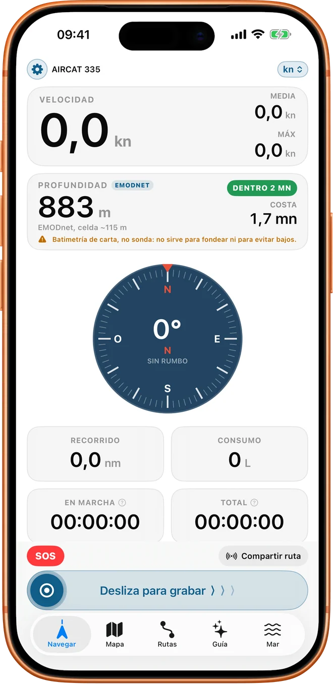
- Worldwidedepth on the map and in Navigate, free
- 2 NMdistance to the coast drawn on the map, in any sea
- 7 daysof forecast at any point, with Pro
- No accounts, no trackingyour route only leaves your phone if you share it or ask for help
What nobody tells you when you've just got your licence
How much water you have under you, how far you can go, where the dolphins are and who to alert if something goes wrong.
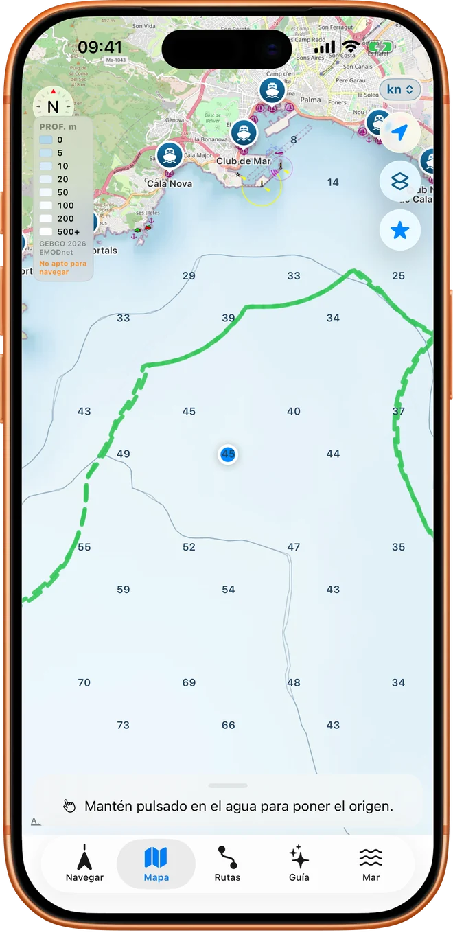
Depth anywhere in the world
The map shades the depth of any sea on the planet and draws the depth contours. In Spain there is also the detailed chart with soundings and veriles (seabed drop-offs), which is built into the app and works without coverage.
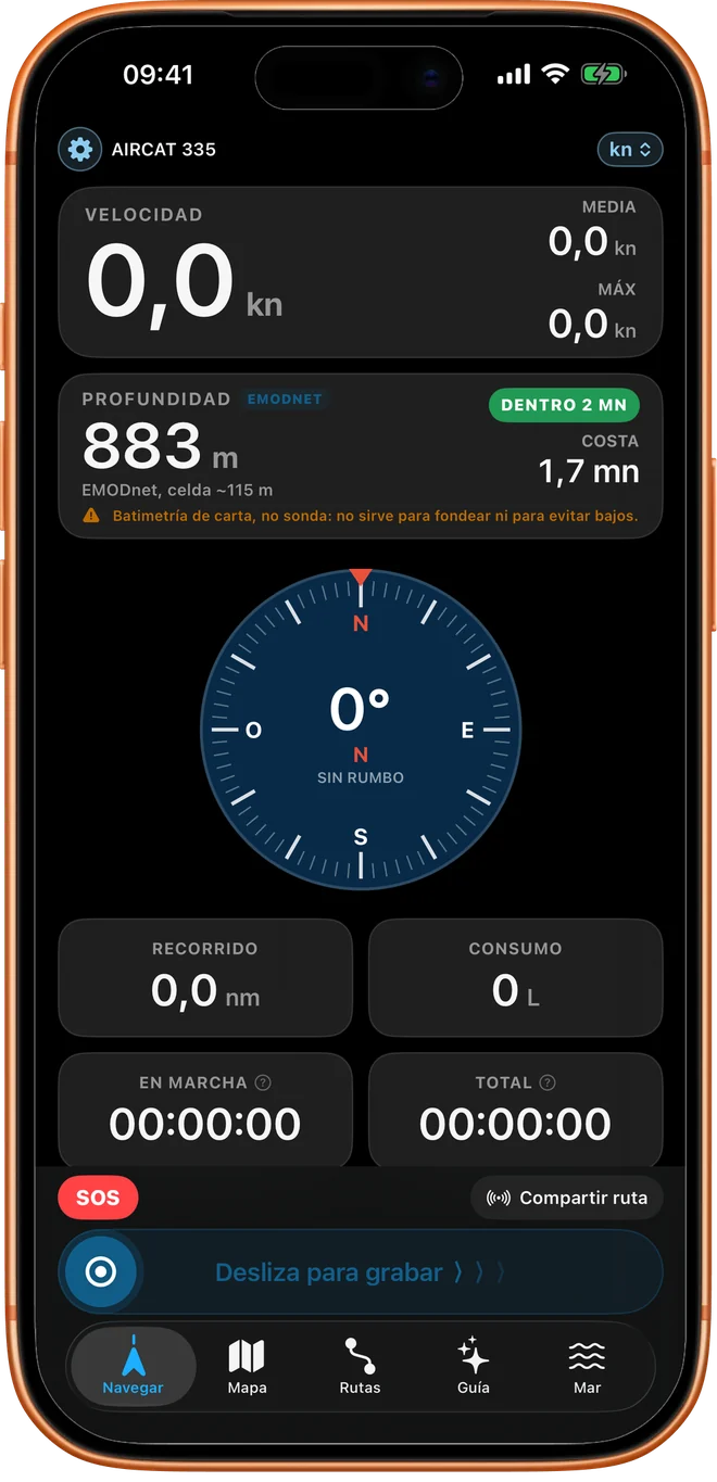
In Navigate, an instrument gives you the chart depth under the boat and the distance to the coast.
This is chart bathymetry, not a depth sounder: it is not for anchoring or for avoiding shoals.
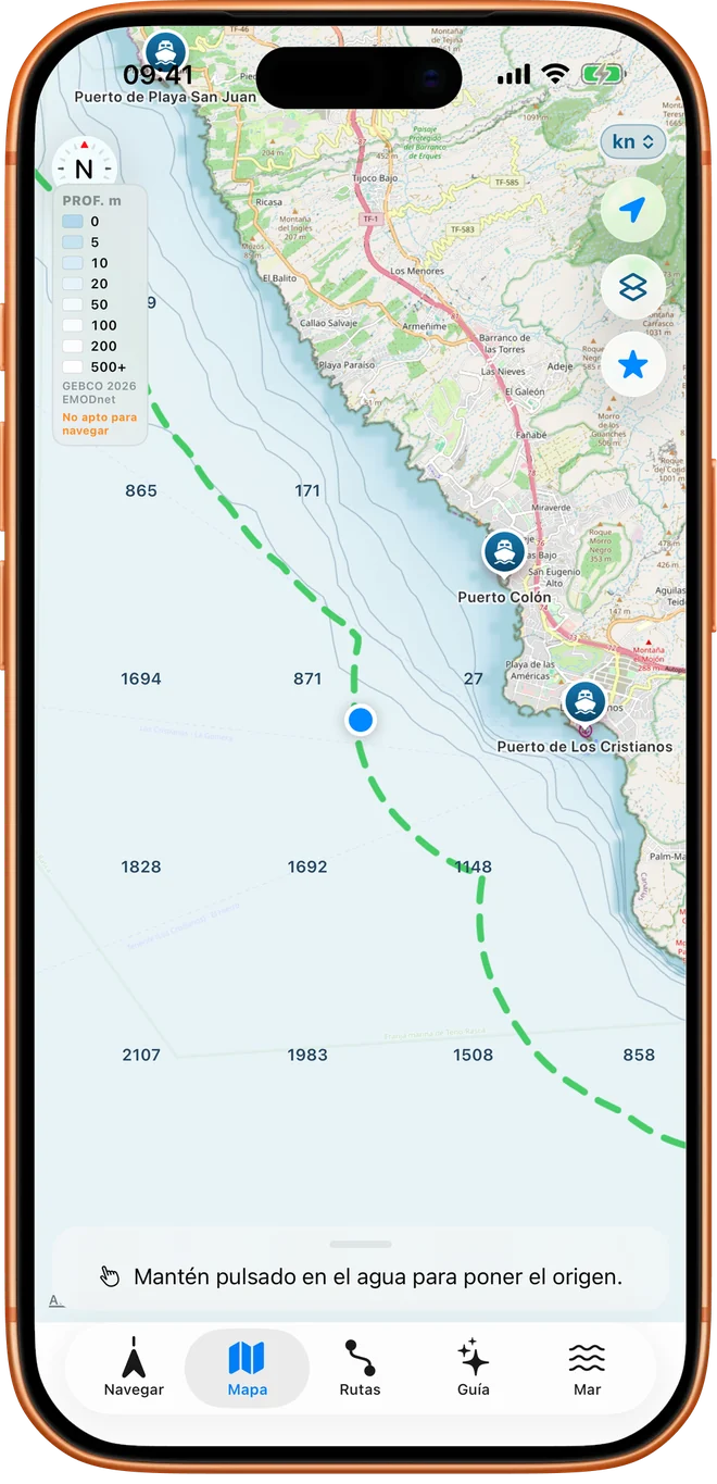
The limit of your qualification, drawn on the map
Choose your qualification and Embarca paints your maximum distance on the map: 2 NM with the Licencia de Navegación (Spain's basic boating licence) or with no qualification, 5 NM with the PNB (Patrón de Navegación Básica, basic navigation skipper) and 12 NM with the PER (Patrón de Embarcaciones de Recreo, recreational craft skipper). It only informs, never stops you from planning, and tells you in plain language what your qualification allows, citing the article of the BOE (Spain's official gazette). The qualifications are the Spanish ones; in other countries the line to the coast works just the same, but you have to check the limits of your own qualification.
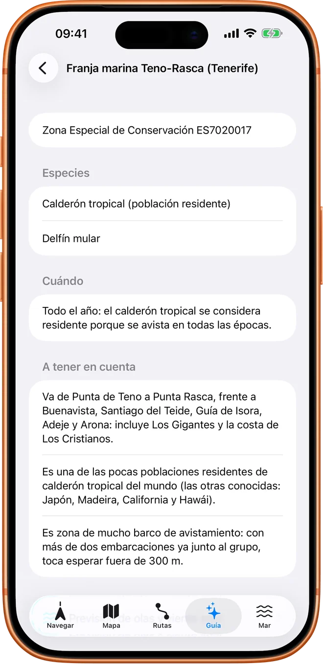
Dolphins and cetaceans of Spain
Sighting areas in the Canary Islands, Andalusia, Murcia, the Valencian Community, the Balearic Islands, Galicia and Asturias, each with its source: protected areas and official studies, not points placed by eye.
With cards to tell the bottlenose dolphin from the common and the striped dolphin, and an illustrated dictionary that explains what a veril (seabed drop-off), a terral (offshore land breeze) or an amura (the bow quarter of the boat) is.
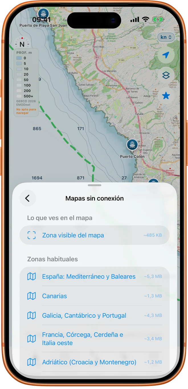
Offline maps
Download the depth and the coast of your areas before you leave and view them in the middle of the sea with no coverage. What you download keeps working for good, even if one day you stop having Pro.
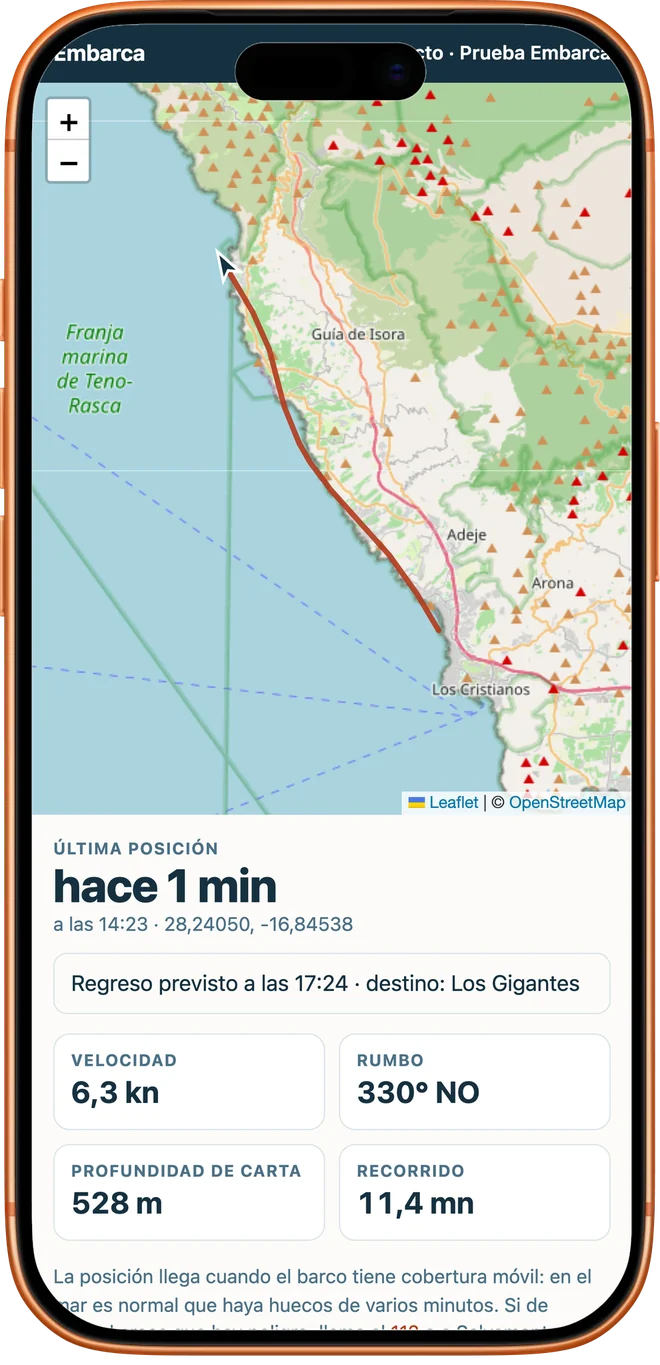
Let them know where you are
You go out alone and they stay calm at home: you share a link on WhatsApp and they see live where the boat is, the route you are following, how fast you are going and when you plan to be back, without installing anything. If you run late, the web page highlights it.
Without coverage, the app stores your position and sends it as soon as the signal returns. The link expires on its own and the route is deleted 24 hours after your last data point, or immediately if you delete it yourself.
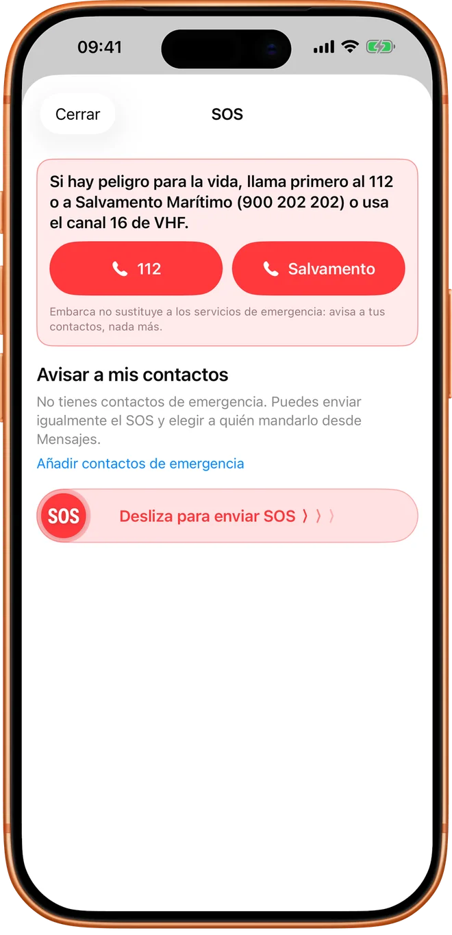
SOS in one gesture
A red button always in view, in Navigate and on the map. You slide it and your emergency contacts, up to three, receive an SMS with your position, a link to follow you live and your route plan. If there is no data, the SMS is sent from your phone. Safety is not charged for: the SOS is free for everyone.
Routes from other boaters, near you
A community of routes that were really sailed: where pilot whales were seen, which cove is worth anchoring in, where people go in an inflatable. Exploring them is free.
Explore and see the detail
In Routes, Community, you see on the map and in a list the routes published in the area you are looking at: sightings, fishing, cruising or anchoring. Each one comes with its track, its photos placed on the map, the distance, the duration, the difficulty and the sea state there was.
Navigate them and publish yours
With Pro you load someone else's route into the planner and follow it in Navigate, or save it on your phone to open it without coverage. And you publish your trips from the logbook, with up to six photos.
Your mooring is never published
The first and last 300 metres of every route are trimmed on your phone before it is sent, so nobody knows where you moor or where you live. You publish under an alias, photos are uploaded without metadata and only the month of the date is shown. Anyone can report a route and we review it.
Free vs Pro
What keeps you oriented and safe is free, and will stay free. Pro unlocks what helps you plan the trip and navigate without coverage.
| Feature | Free | Pro |
|---|---|---|
| Navigate and the chart | ||
| Depth on the map and in NavigateWorldwide, with a connection | ||
| Detailed chart of SpainSoundings and veriles (seabed drop-offs), inside the app and without coverage | ||
| 2 NM line and distance to the coast | ||
| Speed, heading and compass | ||
| Trip logbook | ||
| Your boats, with fuel consumption and range | ||
| Sea and learning | ||
| Cetacean guideAreas of the Spanish coast | ||
| Illustrated dictionary and species cards | ||
| Safety | ||
| SOS with emergency contacts | ||
| Live route tracking by linkLet them know where you are | ||
| Plan the trip | ||
| Offline mapsDownload by area; what you download keeps working for good | ||
| 7-day forecast at any pointWind, gusts, wave, period and sea temperature, hour by hour | ||
| Sighting windowsDaylight hours with a sea flat enough to spot a fin | ||
| Boat launch finderRamps and slipways with access, surface and how to get there with a trailer. For now, the south and east coast of the Iberian Peninsula | ||
| Route plannerRespects the coast, with time, fuel consumption and range | ||
| Route community | ||
| Explore and view other boaters' routesMap, list, track, photos and data | ||
| Publish your routes with photos, navigate and save other people'sOffline, in Planned | ||
You pay once.
Embarca Pro is not a subscription: a €19.99 purchase that does not expire and works for the whole family with Family Sharing. Depth, the line for your qualification, the cetacean guide and the SOS are never paid for.