Why Embarca exists
A small boat is simple and very forgiving, and that is exactly why it comes without what bigger boats have: no sounder, no chartplotter, no screen to look at the sea in any way other than with your eyes. Embarca is the app made for that gap, and this is what it is and what it is not.
The boat and the place
I sail an Aircat 335 inflatable with a four-stroke Mercury 9.9, along the Axarquía, on the coast of Málaga. I also have a Rinker 182. On the inflatable there is no sounder, no plotter, nothing fixed on board: what I carry is a phone, and I want that phone to be good for more than taking photos.
That is the situation of many people who have just passed their licence or bought their first small boat: an inflatable, a RIB, a small powerboat or even a jet ski. A full navigation setup is expensive, takes up room and sometimes simply does not fit, and most of the existing apps are built for bigger boats and longer trips.
The questions that keep coming up
Almost every beginner's problem is the same, and each one has its own guide in this blog:
- How much water is there underneath? For anchoring, for diving or for not touching the bottom. See where to anchor without a depth sounder and how to read a nautical chart.
- How far can I go? Your licence decides: the 2-mile limit.
- When do I go out? On an inflatable a good day and a bad day have nothing in common: levante, poniente and when to go.
- Where are the dolphins and how do I watch them without bothering them? Distances and rules.
- What if I lose coverage or get stranded? No coverage and what to bring.
What I wanted, in three sentences
- An estimated depth for where I am and where I want to go, from nautical charts.
- My routes recorded, so I know where I have been and can go back to the same spot.
- To know when to go out, with a forecast you can understand without being a meteorologist.
Simple, on the phone I already carry in my pocket and with nothing to install on the boat. That is how Embarca came about.
What Embarca is not, and I mean it
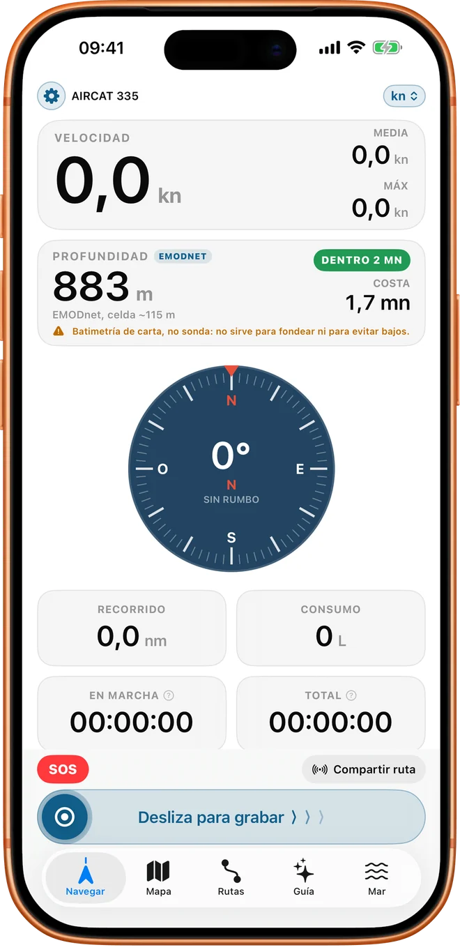
Embarca is not a depth sounder. The depth it shows is an estimate built from chart and bathymetry data, not a measurement of what is directly under the hull right now.
The data has a limit worth understanding: the GEBCO global bathymetry has cells of 15 arc-seconds (about 460 metres), and the EMODnet detail for European waters about 115 metres. Inside a cell that size there can be a shoal, a rock or a step that the data averages out and does not show. That is why the app itself says so: it is chart depth, and on its own it is no basis for deciding a spot is safe or for avoiding a shoal.
What it does do is sort out your doubts: it tells you where to start looking, which areas to rule out and which spots deserve a closer look with your eyes and a lead line.
Who it is for and who it is not
Embarca is for anyone with a boat without a sounder or plotter. If you already have a well-installed Garmin with a sounder, you have depth better covered than I do; what Embarca can add then is the rest: routes, the forecast, your licence line or the cetacean guide. It is not for night navigation relying only on a phone, nor for long passages, nor to replace the official chart and the skipper's judgement. In the comparison with other apps I explain, without attacking anyone, where they are better.
What is free and what is Pro
The rule is simple: safety is free, always. The SOS, "Warn me if I am late", the depth under the boat, your licence line, the online map, today's forecast and the cetacean guide are never paid. Pro unlocks what makes outings more comfortable and better planned: the seven-day forecast, offline maps, the route planner, an unlimited logbook with photos, community routes and the ramp finder.
Pro is a one-time purchase, no subscription, and the Pro trial lasts 3 outings. The full table is in Free vs Pro on the home page.
Data sources cited
- GEBCO, global bathymetry grid (15 arc-seconds; GEBCO itself warns that it must not be used for navigation).
- EMODnet Bathymetry (European digital terrain model of about 115 m).